There are plenty of hikes to do around the Central Okanagan, but Pincushion Mountain occupies a special place in hikers’ hearts.
The iconic mountain rising to the west above Peachland is special enough to warrant a certificate of completion offered by the District of Peachland to anyone who completes the trail.
Pincushion got its name after a fire in the 19th century reduced the trees to short blackened sticks, and the mountain resembled a sewing cushion with pins stuck in it.
The Peachland Post decided to see for themselves why Pincushion and its 245- meter elevation gain is a must-climb for so many. Spoiler alert: it’s all about the views.
Here’s our report:
First you drive up to the trailhead near the top of Ponderosa Drive, preferably on a sunny day. You shoulder a pack with water and snacks, and set off up the trail.
And ‘up’ is the operative word, the first 40 or so meters are steep! Trail builders have installed steps for this early section, and that’s helpful because if, as we found, you do this when there’s been no rain, the packed dirt offers little traction for one’s boots.
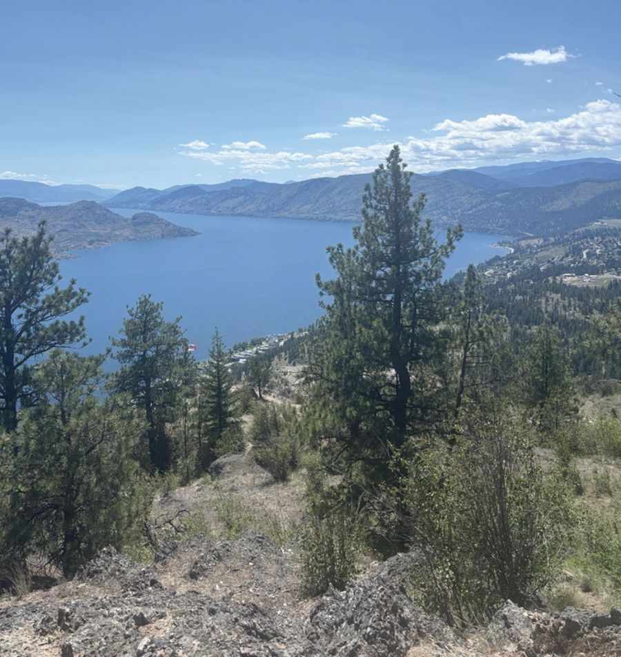
A few minutes up, the trail curves south into open ground, and you are rewarded with the first view of Okanagan Lake, shining like a blue jewel in the sun. The terrain here is flatter and relief for the legs, but to the right the mountain above looks a little daunting.
The trail rises again to the first of many switchbacks. There is some protruding rock but the footing is good, and the view keeps improving as you climb. Typically, legs are burning a little by this time and one’s breath is deepening but that dissipates as you get into the rhythm of the uphill climb.
About ten minutes in, you cross an old road that might have been used for forestry. The trail appears to continue on the other side, so you cross into the forest but almost right away the trail looks faint. Experienced hikers know that if you are not sure you’re on a trail, you’re not on a trail. There’s no mistaking that truth here.
So you circle around back to the road and finally notice an obscurely placed sign on a tree with an arrow pointing to the right. Down the road, you can see an unmistakable crushed gravel trail heading up to the left. You’re back in business.
On the road you may see some fresh bear scat -- a reminder that if you didn’t think to take bear spray with, you should have.
The trail rises, moving through deadfall. As you can’t fight a steep trail, there’s nothing for it except to put one foot in front of the other, stay steady and lean into it. You can’t wish yourself to the top. You can improve your fitness before you go on a hike, but on any given day the mountain is the mountain and you are you.
If you don’t wear high hiking boots you may need to pause to remove gravel and debris. But despite that discomfort it’s likely that by now your legs have warmed and are no longer complaining about the slope.
Soon you are rewarded with the first major open view on an exposed bluff. This height lets you see far up the lake almost to Kelowna, and far down the lake almost to Summerland. The switchbacks continue and you are climbing steadily up in a westerly direction. It’s nice to see a little blue and white marker with a stick figure hiker on it indicating that you’re on the trail, but there’s really no mistaking it.
Now the Ponderosa pines are a bit thinner and shorter, and the trail curves to the south toward a series of higher bluffs. If this is unfamiliar territory you won’t necessarily know which is the summit. The trail splits off here and one part heads west. To where? Somebody in Peachland knows.
But you continue southward on what is another less-used but clearly travelled trail that heads up to switchbacks. You want to watch your left Peachland below is getting smaller and smaller, and more of Okanagan Lake is visible to the south. Plenty of birds and butterflies are around, and you probably want to pause to take photos.
Now the trail drops about 10 metres down the side of a bluff, and you are down climbing using handholds and footholds. A little tricky, and one wants to be careful here. A fall wouldn’t likely be fatal but you’d bounce off a few rocks on the way down.
The trail then rises to another bluff, which requires another tricky downclimb on the other side. You may think you are close to the top but this is a false summit. That’s when you think you will be finished just over the next rise, but there’s another and another. If you’ve hiked in the Rockies you will be used to that.
But eventually you do get to the final bluff, almost a table-top, and it’s an unrivalled and spectacular view. Peachland lies far below, and Okanagan Lake stretches to the northeast and south. A maze of trails around the summit offers lots of different angles and places to take photos.
Or you can just enjoy the incredible lake views and mountains stretching off into the distance in many directions. There’s a Canadian flag and a guestbook to sign south and a little below the summit bluff.
It may have taken you an hour or so to make it this far, and you are now eligible to join the “I’ve done Pincushion Mountain” club. Now, all you need do to is to get down and apply to the District for your certificate of completion.


