For the latest updates on the fire, click here to read NowMedia's new story.
**NowMedia's previous coverage of the Mine Creek wildfire can be found at this link.**
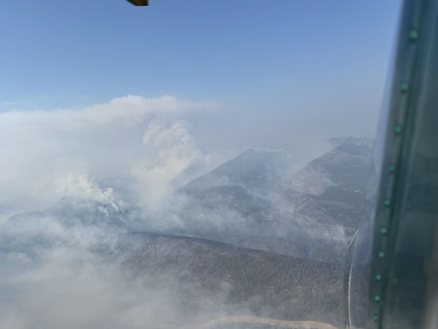
(UPDATE: Sept. 7 @ 10:59 am) - The BC Wildfire Service is continuing to attack the Mine Creek wildfire burning around parts of the Coquihalla Highway south of Merritt.
In the latest update from the BCWS, the service stated that a downturn in weather may help the fire’s behaviour calm down to a smouldering ground fire and low vigour surface blaze.
However, Thunderstorms with precipitation are in the forecast for this afternoon, which could produce gusty, erratic winds that lead to an increase in fire behaviour and heavy downpours, which can make the nearby highway and back roads wet and slippery.
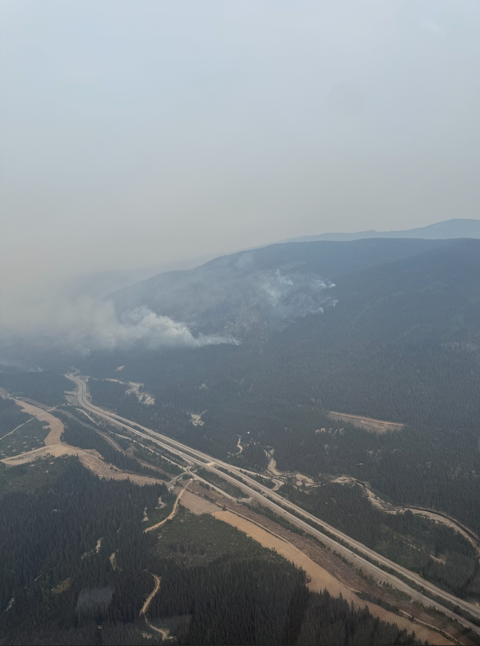
“We continue to work on securing the Coquihalla Highway corridor to ensure public safety and maintain access along the corridor,” wrote the BCWS.
“Crews are conducting direct attack and mop up along the southwest flank of the fire, working up to 50 feet in from the fire's edge.
Crews are clearing combustible vegetation from the northern flank of the blaze along with danger tree assessors and fallers, who are conducting falling operations.
“Structure protection crews have established structure protection on critical infrastructure, including communications towers, and recreational properties along the Coquihalla corridor,” added the BCWS.
“These crews continue to monitor structure protection on these values and triage any new values discovered. Heavy equipment is constructing containment lines along the northeast side of the fire.”
When visibility permits, aircraft are supporting ground crews, with helicopters bucketing and securing the fire perimeter along the highway and the north and south flanks of the blaze.
Drivers along Hwy 5 are asked to “exercise extreme caution” when driving through the area, as it is an active work site and crews are either working alongside or potentially on the highway.
Up-to-date road conditions can be found online at this link.
(UPDATE: Sept. 6 @ 4:35 pm) - The BC Wildfire Service (BCWS) has gotten a more accurate assessment of the Mine Creek wildfire burning along the Coquihalla Highway.
Earlier today, the service updated the size of the fire to 3,390 hectares.
The update added that the blaze was burning as a low vigour surface fire, with pockets burning as a moderately vigorous surface fire. The fire’s behaviour is expected to increase today (Saturday).
Crews have been working along the Coquihalla to secure the highway corridor, conducting direct attacks on the east side of the corridor and working to establish control lines along the north flank of the fire.
Heavy equipment has also been called in to construct control lines along the north and south flanks of the east side of the fire.
“Aircraft are supporting the work of ground crews when visibility permits, with heavy lift helicopters bucketing and helping secure the fire perimeter along the highway and the north and south flanks of the fire,” stated the BCWS.
“Today, our heavy lift helicopters are bucketing along the southwest flank to bring down fire behaviour and slow spread.”
Structure protection has been established along parts of the highway.
(Original story: Sept. 6 @ 9:30 am) - Improved visibility has allowed crews to get a more accurate measurement of the Mine Creek wildfire burning along the Coquihalla Highway.
In a Saturday morning BC Wildfire Service (BCWS) update, the agency stated that the fire is 4,100 hectares in size.
The BCWS added that smoke from the fire and an inversion helped settle the blaze’s behaviour on Friday and it was burning as a low to moderately vigorous surface fire.
With the fire burning in workable ground, compared to the previously steep, inaccessible terrain, crews are establishing control lines along the northern flank and conducting mop-up along the highway corridor.
“Aircraft are supporting the work of ground crews when visibility permits, with heavy lift helicopters bucketing and helping secure the fire perimeter along the Coquihalla Highway and the north and south flanks of the fire,” wrote the BCWS.
While Hwy 5 is open in both directions, drivers are being warned to expect intermittent lane closures, reduced visibility and crews working in the area.
Up-to-date road conditions can be found online at this link.


