It was 16 days ago that the Upper Park Rill Creek wildfire, on a mountainside just south of Twin Lakes and approximately eight kilometers west of Okanagan Falls, exploded onto the scene.

And explode it did. Within three hours of its birth it looked like this.

But even that early it was being fought by a pure show of force -- at least five amphibious skimmers from Alberta, three air tankers (and a birddog to lead the way), two helicopters, and whatever ground crews and ground equipment BC Wildfire and local fire departments could get on the scene and deployed.
It was a heck of a power play considering all the other serious wildfire activity (West Kelowna's McDougall Creek and Keremeos' Crater Lake, for example) at the time.

But the immediate beat-down seemed to work.
Sure, in the midst of the extreme temps and high winds of mid-August, the aggressive fire hit 740 hectares before the day was out and nearly doubled that size by the next day. And within hours, thoroughfares throughout the region were closed and 250 properties -- many perilously close to the blaze on the long and winding Grand Oro Road -- were given evacuation orders.

But the fire didn’t grow much beyond that. Today, even though it's still considered a "Wildfire of Note," it's almost the same size (2043 hectares) it was ten days ago and it's just 900 or so more than it was at the end of Day One, when it looked so incredibly threatening.
Even better news, all evacuation orders were rescinded within the first seven days.

It would appear to be an incredible job of snuffing a raging fire, so PentictonNow visited the scene late last week to see what it looked like.
It was a remarkable transformation. When we were there on the 18th, the skies were filled with aircraft and the fire was a raging beast, spewing flames and plumes of multicolored smoke. One day later when we returned, the scene was so smoky we could barely see what was going on.

But now, all appeared to be back to normal. On that original mountain, we saw no smoke and certainly no flames. All the roadblocks has been removed. And the scene at first seemed quiet.
But those initial impressions were only fleeting. We stuck around for a bit and soon realized the area was still very active.

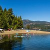
Soon, we heard a helicopter. Then another, then another. Three of them in all still continued the battle from the air, refilling their buckets in one of the two Twin Lakes and zipping off to drop it on the remaining hot spots. Over and over and over again.

Only now those hot spots were far less hot. And they were a couple kilometers or more to the southeast from the fire's origin and initial focal point.
Seemed the blaze ultimately followed the path projected on Day 1, when BC Wildfire evacuated the community of Willowbrook, several kilometers to the southeast and in the direction of the prevailing high winds at the time, but didn't evacuate Twin Lakes, closer to the fire but in the opposite direction.

Another big win for BC Wildfire.
We next drove eastbound on White Lake Road toward Dominion Observatory, all of which had been behind roadblocks in the first few days. As we drove, the signs of the battle and its aftereffects became much more obvious.

Like the sections of fencing torn down to allow gear and firefighters to pass through on their way to the flames.

Or the pieces of heavy equipment still scattered roadside.

Or the scorched landscape and burned trees, particularly near the top of that original mountain.

Or the "burn-off" zones, where ground crews with torches carefully ignite all the "fuel" (easily burned vegetation) along prescribed strips of land lying near the leading edge of the active fire. Once a burn off is complete, there's theoretically nothing flammable inside that area -- the idea being that flames can’t advance any further if they have nothing to burn.

Imagine a moat around a castle.
In the case of the Upper Park Rill Creek wildfire, those burn-off strips/zones are particularly striking in that they, for the most part, are perfectly straight for hundreds of meters at a time.

Kudos to the skilled guys and gals with the torches.
But when we looked even closer through our long lens, we realized there was action on the ground too -- personnel with shovels and axes and other tools of the trade still looking for potential trouble and dealing with it when they found it.

We ended up speaking with one of them, who generously took a few minutes to answer our questions and clue us in to stuff like "burn-offs" but would rather remain anonymous.

A couple kilometers east on our journey, we saw traces of smoke in several locations, each offering more proof as to how recent this fire was but most seemingly coming from still smoldering, burned-out husks of trees.

Given the number of firefighter eyes on the situation, from those still inside the zone to those in the sky and those scanning the region from pickup trucks, we knew each instance was well in hand.

Ultimately, the Upper Park Rill Creek wildfire has unquestionably altered the landscape of the sweeping geological area between Twin Lakes and White Lake. And certainly anyone driving or biking through this visually dramatic region -- and it is especially popular with cyclists -- will immediately see the new, charred reality.

But that it didn’t grow any larger or do even more damage when it certainly looked capable of doing so initially is testament yet again to the skill and the determination of our firefighters -- at a time when they were spread especially thin.


